Friday, October 31, 2008

Where was Senegal (250 million years ago)?


Photos (top to bottom):  Illustration showing the extent of the Tertiary and Quaternary volcanics on the Cap Vert Peninsula;  the relative position of present-day continents in Pangea;  the collision of Laurentia and Baltica led to the formation of the Appalachians, the Caledonides, and the Mauretanides;  map illustrating the geological associations among mountain belts across continents;    a cross-section illustrating the separation of the Appalachians and the Mauretanides;  map illustrating the possible historical links between the North America and West Africa;  the stratigraphy of the Senegal Basin (note the references to pre-, syn-, and post-rift sections).


The kids and I are currently exploring the geology of the Cap Vert Peninsula.  Generally speaking, two major volcanic periods occurred here:  the first centered to the south during the Tertiary, in the area of Cap Manuel;  and, more recently, in the Mamelles area during the Quaternary.  Thus our field trips to Cap Manuel last week, and to the Mamelles this coming week.

A basic question has been this:  In the context of Pangea, 250 million years ago, where was Senegal (in respect to North America).  Was it adjacent to the southeast United States?   What's the evidence?

With the assistance of USGS geologist Paul Schuster, and Professor Ngom, we've discovered that, during the Triassic, Morocco was juxtaposed beside Nova Scotia, and the mountains of the Mauritania were continuous with the Appalachians.

Here are the details:  During the Devonian Period (416 - 360 mya), long before the formation of Pangea, there existed two large continents:  Euramerica, which straddled the equator, and Gondwana, which occupied much of the southern hemisphere.

Euramerica was formed from the collision of two other landmasses, Laurentia and Baltica, the result was the formation of  a mountain chain stretching south to north across the young continent. 

By the end of the Carboniferous Period (300 mya), the continents of Euramerica and Gondwana had fused together to form Pangea.  The splitting apart of Pangea, and the formation of the Atlantic Ocean, divided Euramerica's mountain chain.  The two halves drifted apart, bordering either side of the expanding Atlantic, forming the Appalachians, the Caledonide Mountains of the British Isles, Scotland, Norway, Sweden, and eastern Greenland, and the Mauritanides of western Africa.

While I'd love to find direct evidence of the connection between the Mauritanides and the Appalachians, there's not much to be found here.  The coasts of Senegal, Guinea Bassu, and Mauretania lie on a coastal basin, west of the Mauritanides Belt.  We are riding on a thick layer of sediment.  Reaching the deeper, pre-rift and syn-rift layers (referring to the period prior to and during the breakup of Pangea) requires drilling equipment, which has been done.

Sunday, October 26, 2008

ROVing on Ile de Madeleine


Last Sunday, Randi and I headed out to Ile de Madeleine (a marine preserve and national park located a couple of miles from the mainland) to deploy our middle school ROV, accompanied by four students and their families.  We had a much larger group interested in attending, over 40, but the little boat that ferries passengers over to the island carries a max of about 20, and the turnaround time is about an hour.  The park's second boat apparently ran aground, and was out of commission.

This was an exploratory trip, both to check out the performance of the ROV in saltwater, and to scout out preferred launch sites.  Unfortunately, there was a swell/surge, and a lowering tide, which became a very, very low tide.  Despite this, the trip was quite successful.  Note the media on BOT at http://www.becauseoftime.org/ISD/ROVMission1Media.html.

Our next ROV excursion to Madeleine is set for Saturday, November 8th, with a new group of kids and families attending.  The challenge here is identifying locations for the deploying the vehicle which we can get to easily.  Certainly, we will charter a boat, upcoming, and find a way to do a night dive.  This is the fun of this work:  solving real problems in real time.

The bottom pic above is of pottery samples discovered on the island, typically found in association with shell mounds.  Their age varies widely, from several hundred to several thousand years old.  The same decorative style is found in Cap Manuel, Goree, Yoff, presumably Ngor, and all along the coast.  The patterns were made by rolling braided fibers, or similar, across the surface of the still-wet clay.


Geology of Dakar Revisited


Randi and I visited with UCAD geology professor Dr. Malick Ngom again on Saturday morning.  I came armed with a list of follow-up questions regarding the natural history of the Cap Vert Peninsula.  

Dr. Ngom was interested in several images he'd seen on BOT, taken during our walking field trip to the shore. (Note the top image above.)  He explained that that local volcanic rock, dolorite, has been mined over the years and used as a construction material in the building of both houses and roads.  The concussive formation we'd observed along the shore was, in fact, not natural, not the result of a lava bomb (what we'd speculated, however fancifully), but where a hole had been drilled for a stick of dynamite.  BOOM!

The next pair of images above are of xenoliths, when rock becomes incorporated into hot magma, and appears as a distinct discoloration in the matrix.  The upper image was taken on our field trip, the second image shows a boulder of granite from the Sierra Nevada Mountains of California.  While the two images reflect very different histories, both nicely illustrate how one kind of rock might be incorporated into magma.

Dr. Ngom speculates that the final two images (the top taken during our field trip, the bottom taken on Saturday) suggest that gas traveled from below, through the matrix, leaving what appears to be a vertical channel of stone with large vesicles or holes.  

He also confirmed that the Cap Vert Peninsula was not a volcanic island which later became joined to the continent.  Not so.  The Tertiary volcanics were continental, as suggested by the extensive distribution of basalt columns above and below sea level.  The channels of water, on either side of the peninsula, reflect N-S running faults.  

Though he was quick to explain that everything is context specific:  every snapshot must be considered with respect to it's position.  The rock tells a story, and reflects a complex interaction of events.  

Cool, eh? Not a rock fan?  Shame.  There's still time.  Stick with me.


Saturday, October 18, 2008

Visit with UCAD Geologist Malick Ngom


(Photos top to bottom)  Randi on the southern tip of the Cap Vert Peninsula, with a dramatic exposure of the quaternary volcanics, including basalt columns (a la Devil's Postpiles in CA, or Devil's Tower in WY);  on the west side of Cap Manuel looking toward Ile de Madeleine;  an exposure on the east side of Cap Manuel, showing bedrock limestone with volcanic intrusions.

I'd been looking for a UCAD (Universite Cheikh Anta Diop) geology connection even when still in the States, knowing that I'd need mentorship in learning the geology of the Dakar area.  I found that contact in Professor Papa Malick Ngom, a very warm and engaging geologist with whom Randi and I met on Saturday morning.  Fortunately, his good English more than compensated for our bon jour French.  

This we learned:  The Cap Vert Peninsula was formed as a result of two series of volcanic events, the first during the Tertiary, and the latter during the Quaternary.  Prominent landforms -- the Mamelles, Cap Manuel, the islands of Madeleine and Goree, and the extensive exposures of columnar basalt -- all reflect this turbulent history.

The breakup of Pangaea, and the spreading of the continents, resulted in a series of north-south running faults extending into Senegal, like stretch marks.  In the Tertiary Period, magma squeezed its way through weaknesses in these faults, resulting in simultaneous volcanic events on the Cap Vert Peninsula (Dakar), the Cape Verde Islands, and the Canary Islands.  Several major volcanic events took place during the Miocene (dated to 21 Ma, 15-10 Ma, and 8.5 - 5.3 Ma).  The basalt associated with the Tertiary volcanics in the vicinity of Cap Manual (a hill on the southern end of the Cap Vert Peninsula) is called ankaratrite, or nepheline basalt, a type of basalt characterized by the presence of a particular composition of minerals.  

Ile de Madeleine and Goree were also formed at this time.

The thick ankaratrite layer weathered at its surface forming an red-colored, iron-rich soil called laterite.  As Professor Ngom explained, the laterite is an important reference point with respect to dating:  everything beneath the laterite is Tertiary, and everything above is the result of Quaternary volcanics.

Randi and I walked to Cap Manuel from downtown Dakar, crossing two east-west running faults, which are now evidenced by dips in the road.  We walked the whole way around Cap Manuel, with expansive views of Madeleine and Goree from the high basalt bluffs.

On the east side of the Cap, we happened by several exposures of the bedrock limestone underlying the ankaratrite.  I suppose only the most nerdy of us would find this interesting.  Randi waited for me in the shade of a tree while I went exploring.

When you fly into Dakar, you'll note a lighthouse atop one of two hills toward the northern end of the peninsula.  They are the Mamelles, meaning breasts in French.  (I'll edit out the obvious puns here, so as not to offend the two people who will read this far into a blog entry about rocks.)  It is true that the Mamelles were once volcanos.  The stratigraphy of the area makes this clear.  The coastal bluffs of the Mamelles reveal a number of volcanic events, separated by layers of sediment, very much like the pages of a book.  The basalt here is of another mineral composition, called dolerite, which generally forms in shallow intrusions, pushing between layers of sedimentary rock.

The age of the Mamelles volcanism is around 1 mya.

A little trivia:  On  field trip last week, we walked down to the shore, not too far from school.  Fascinating area.  Complicated.  Lots that I didn't understand at the time.  In the Sierra Nevada of California, there is a kind of rock called a xenolith, or a small rock that becomes absorbed into a larger rock, as when the so-called country rock become integrated into a subsurface bubble of magma.  Driving across the High Sierras from Sacramento to Reno you see loads of examples of xenoliths, as grey patches in the granite.  We found abundant evidence of similar things last week, as if one rock was incorporated into something larger.  Dr. Ngom confirmed that this was the case, and offered several explanations.  By example, the magma ejected from its source may have carried with it some of the basement rock, which became absorbed/incorporated.

I'm sorry . . . I find this stuff interesting, and now you know better than to take me on a drive.  I read in an article by UCAD Archaeology Lab Director Ibrahima Thiaw;  he wrote that many Senegalese equate archaeologists looking for pottery shards and such as a kind of  insanity.  No doubt the spouses of archaeologists agree.  

A fellow sniggered yesterday as I walked by, my eyes to the ground, turning over rocks and pottery, ostrich-like.  I didn't take it personally.  Maybe a bit of Thorazine would help.


Saturday, October 11, 2008

In Search of Prehistoric Senegal


Photos from the Archaeology Laboratory, Institut Fondamental d'Afrique Noire, Cheikh Anta Diop University, Dakar.

Dr. Ibrahima Thiaw is an Associate Professor of Archaeology at the Institut d'Afrique Noire (IFAN) at the Cheikh Anta Diop University in Dakar.  Dr.  Thiaw is also Director of the Archaeology Lab, and Curator of the IFAN Museum, located in downtown Dakar, which my students visited a few weeks ago.  We met with him this morning, and toured the Archaeology Lab, and its extensive collection of pre-historic artifacts from Senegal and West Africa.

It is with Dr. Thiaw's support and resources that I hope to piece together the pre-history of Senegal, for presentation to a general audience, as the ISD international community of parents and kids.  It is certainly a story unknown, and thus worth telling.

The interest in archaeology here in Senegal is slight to none.  Building projects, which are abundant here on the peninsula, require no prior archaeological survey.  Across the country, key archaeological sites have been obliterated, perceived as culturally irrelevant.  It has been Dr. Thiaw's mission to reverse this trend, thus his welcoming attitude toward schools, classrooms, and children.

I expressed my interest in museum apprenticeships, and a desire to create a link between my class and the Archaeology Lab, perhaps laying the groundwork for digitizing the collection, making it available to schools and teachers.

Exploring Yoff


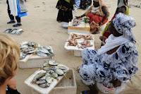
Photos (top to bottom):  Mausoleum of the Holy Prophet Seydina Limamu al Madhi in Yoff;   a interesting building near the Mausoleum of Seydina Rohou Lahi Issa (son of Seydina Limamu) in Caberene, just north of Yoff;  fish market on Yoff Beach;  Gaucher & Meriam in a wobbly, too-small pirogue en route to Yoff Island;  pirogue on Yoff Island looking back toward Yoff Village;  pottery & shells on Yoff Island.


ROV Pool Test


Photos (top to bottom):  Members of the ROV Team (Julia, Jonathan, Damir, and Tyne) from video filmed from the SS-MS Sub.

The middle school ROV Team tested our first vehicle last week in the Club Atlantique pool, which is adjacent to the school.  All went smoothly, save for the fact that the ROV was heavy in the water.  

For my former ROVers and families, here are the specs:  The vehicle has a clean look, with all wires threaded through the frame, emerging at the back, save the single video cable, which is cable-tied to the exterior of the frame.  It is powered by a standard three 800 gpm bilge motors, two horizontal, one vertical.  The camera we're using is equivalent to the Emily Cam we had last year, available over-the-counter at Fry's Electronics and Amazon.com.  The tetherline is composed of four 18 gauge wire pairs, 10 meters long, bundled with the camera cable in a thin-walled rubber conduit, split along its length.  The control box has three momentary toggle switches, and a on/off switches for the lights.

The video cable connects to a video splitter/amp, sending a signal both to a DVD player, used as a monitor, and a video camera, for recording.  (All of these components are the same as those used last year.)  Systems are powered by two small 12v batteries, 7 and 10 amh respectively, too low for operation on the sea, but good enough for now.  I found a 12v 27 amh sealed gel battery locally for about $150, not a bad price considering the source.  In the meantime, I'm hoping to ship my recharger from California, not available locally.

For pics and video of this maiden voyage, see BOT at http://www.becauseoftime.org/ISD/ROVMission1Media.html (Gallery 5).

Next steps: Refine buoyancy, practice piloting;  do a ocean test, recalibrate buoyancy;  identify potential dive sites;  focus on logistics (what do we do once we get to a dive site), water safety, and collaboration-collaboration-collaboration.

Saturday, October 4, 2008

Storm Front in the Rainy Season


Photos top to bottom:  Randi with binoculars bird watching, with Dakar in distance;  pan of three images looking west toward oncoming storm front.


Paleolithic Senegal


Photos top to bottom:  Ferry headed to Goree Island from Dakar;  looking back to Dakar;  the Goree cove where the ferry docks . . . note the swimmer doing laps between cement landing, he was flipping his turns!;  map in the Goree Historical Museum showing Neolithic sites;  an assembled Neolithic pot with decoration consistent with what we found on Ile de Madeleine.


We spent the day on the island of Goree a day ago, went particularly with the aim of visiting the Historical Museum, and its collection of pre-historic (paleolithic and neolithic) artifacts.

Goree has a rich history, variously occupied by the Portuguese, French, Dutch, and the English.  The island is notorious as a point of deportation for the slave trade over several centuries.  Note http://webworld.unesco.org/goree/en/index.shtml for a virtual tour.

The study of ancient civilizations is the domain of grade six in most international and American schools.  Following our current unit on geology (and the geological history of this place, Dakar and the Cap Vert Peninsula), we will turn to pre-history, again emphasizing the pre-history of the peninsula.  The Historical Museum on Goree presents evidence for the occupation of the Dakar area as far back as the paleolithic.  The question is:  Where are all the artifacts housed?  We need to find this out?  Very exciting.

A unique feature of Senegal and Gambia are a complex of over a 1000 megalithic stone complexes, including an estimated 212 pillar-circle sites and 251 stone cairns surrounded by stone walls, all dating to 1000 years ago.  The purpose/function of these complexes remains uncertain.  

See Spot Slither


Randi accompanied Lisa M to Ebetts Field, a large athletic field and garden owned by the US Embassy.  Lisa wanted to check out the garden, which is used for a Boy Scout project.  When they reached the brick walkway, which winds through raised bed plots, Lisa suggested that they stomp their feet, to scatter the snakes.

Lisa's husband, Bruce, believes that the completion of the Corniche (the road that runs along the coast from the Almadies into Dakar, completed in advance of a big international conference last year) reduced our local population of spitting cobras and black mombas.  The construction cut back much of the underbrush, where the snakes tend to hang out.

Let's play a little free association:  I say a word or phrase, you say the first thing that comes to mind.  Okay, here goes:

Number one:  Spitting cobra . . .

Number two:  Black momba . . . one of the most dangerous and feared snakes;  the largest venomous snake in Africa, and reputed to be the fastest snake, clocked up to 12 mph.

Randi and I went for a walk along the Corniche past Ebbets Field today.  Interesting how the experience of going for a walk changes once you've got the image of a hooded serpent locked in your imagination, something like swimming while humming the theme to Jaws.

Thursday, October 2, 2008

Dakar Diving


Video top to bottom:  Gabby H. and Jose F. descend the anchor line through a stiff current;  Deb N. ties a bolen at 80 feet;  the advance class gather at depth to complete two cognitive tasks.


In anticipation of clear waters, world-class surf, and a fledgling ISD-ROV team, I carried to Senegal an underwater video housing and a Song HD camcorder.  (A Light & Motion Stingray housing, and a Sony HC7 HD camera, to be precise.) 

Divemaster, Bruce M., allowed me to tag along on his advanced dive class, providing the opportunity to test the housing and camera.  The three clips included here were filmed in about 80 feet of water during the class.  Students were asked to complete two tasks at depth (writing the alphabet backwards, and tying a bolen), comparing their speed/accuracy with results recorded earlier on land.